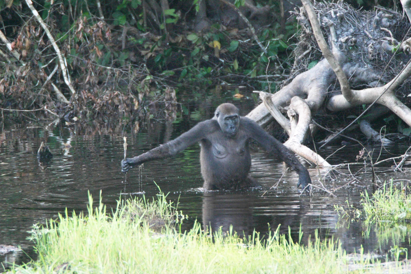
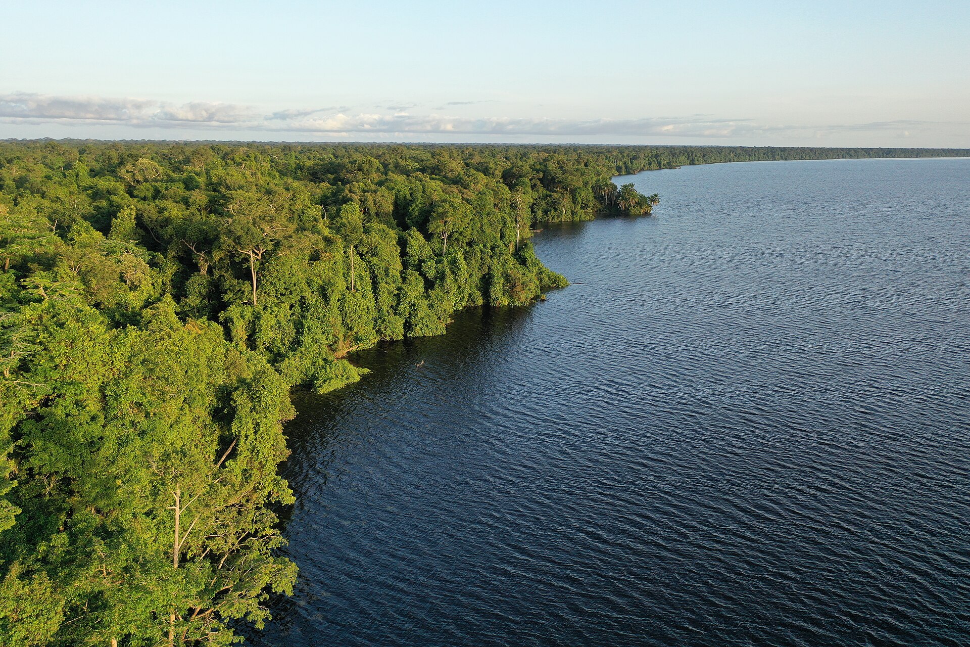
The route compresses several ecosystems into one journey and can reveal primates, turtles and marine life without leaving the protected area.
Use an experienced local guide and begin early, when wildlife activity, water levels and cooler conditions are most favourable.
Look a little closer
Worth discovering
The details that make Conkouati-Douli different.
Destination view
01
Conkouati Lagoon
A large coastal lagoon connects inland water and sea.
Destination view
02
Atlantic turtle beaches
Seasonal nesting occurs on remote sand.
Destination view
03
Forest-savanna mosaic
Habitat changes quickly across short distances.
Photo journal
A closer look at Conkouati-Douli
2 photographs
01Mangrove du parc de Conkouati02Conkouati-Douli — view 2
Deep background
Conkouati-Douli beyond the first view
Lagoon, forest, savanna and Atlantic beach meet near the Gabon border in a protected coastal complex. The view is only the surface of a longer story of formation, use and change.
3 min readAtlantic border region, Republic of the Congo
Conkouati-Douli is centred on Atlantic border region, where lagoon, forest, savanna and Atlantic beach meet near the Gabon border in a protected coastal complex. The strongest reason to make the journey is to cross the lagoon from forest edge to ocean beach.
The familiar invitation at Conkouati-Douli is “Cross the lagoon from forest edge to ocean beach”, yet that image makes more sense when it is connected to the landform, the local economy and the changes that determined access. The route compresses several ecosystems into one journey and can reveal primates, turtles and marine life without leaving the protected area.
At Conkouati-Douli, the form of the landscape explains many of the choices that came later. Dense canopy limits long views, making rivers, clearings, ridges and waterfalls the key points of orientation. Humidity, rain and trail conditions shape the pace more than the distance alone.
The canopy at Conkouati-Douli is not uniform. Around “Conkouati Lagoon”, changes in moisture, elevation or past use reveal its internal structure. A large coastal lagoon connects inland water and sea.
02
Settlement and memory
Routes, livelihoods and belonging
Conkouati-Douli spans Vili coastal lands where fishing, lagoon use and forest products supported villages long before modern borders. Colonial extraction and later oil exploration altered the coast and brought roads into previously isolated forest.
The national park was created in 1999, joining marine waters, lagoons, savanna and rainforest. It protects nesting turtles, chimpanzees and elephants that move unusually close to the Atlantic.
03
Modern history
The change that redefined the place
Oil infrastructure, industrial fishing and community resource needs make this a negotiated conservation landscape. The park's coast-to-forest design is valuable precisely because no single habitat can be protected in isolation.
04
Details to read
What to read in the landscape
At Conkouati-Douli, the feature “Conkouati Lagoon” provides a precise clue to how the landscape works. A large coastal lagoon connects inland water and sea. At Conkouati-Douli, it gives a concrete reference point for reading change rather than merely collecting viewpoints.
At Conkouati-Douli, the feature “Atlantic turtle beaches” is one of the most useful pieces of visible evidence. Seasonal nesting occurs on remote sand. At Conkouati-Douli, it gives a concrete reference point for reading change rather than merely collecting viewpoints.
Start with the feature “Forest-savanna mosaic”, because it condenses a much larger part of the story of Conkouati-Douli. Habitat changes quickly across short distances. Its position and condition at Conkouati-Douli connect physical history with the way people use the place now.
05
Season and scale
Why the landscape still feels dynamic
At Conkouati-Douli, light, water and temperature reveal different structures at different times of year. For Conkouati-Douli, the most reliable visiting window is Jun-Sep.
For Conkouati-Douli, the stated visiting window is Jun-Sep, but its practical meaning depends on local weather, water and transport rather than the calendar alone.
Placed within its wider geography, Conkouati-Douli is not an isolated exception. Beyond the best-known image of Conkouati-Douli feature, Conkouati-Douli matters because atlantic turtle beaches and forest-savanna mosaic place the destination inside a broader regional story.
Chronology
Key dates
Lagoon and coastal livelihoods
Fishing and forest use connected villages across the border region.
Oil and transport development
Exploration and roads changed access to the coast and forest.
National park established
Marine and terrestrial reserves were combined into one protected system.
Travel notes
Plan your visit
Time needed
3-5 days
Getting around
Local guide, river transport and forest walking
Effort
Moderate to demanding
Plan first
Guide, permits, health preparation and transfers
Time of day
Early morning and late afternoon
Best window
Jun-Sep
Traveller stories
Stories from people who have been here.
First-hand moments, practical notes and overlooked details from Conkouati-Douli.