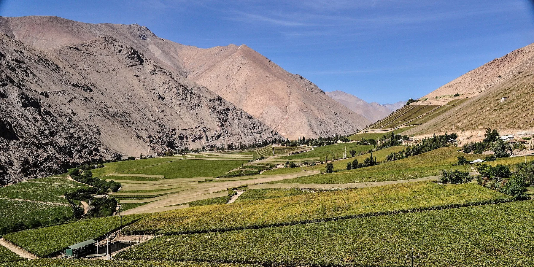
Jagged peaks above the Beagle Channel

Dientes de Navarino

A jagged subantarctic mountain circuit above the Beagle Channel, with peat bogs, lakes and severe weather near the southern edge of inhabited South America.

TrekkingSubantarcticRemote mountains

Location
Navarino Island, Chile
Best window
Dec-Mar
Suggested stay
5-7 days
Go for
Serious end-of-world trek
The reason to go

A compact trek with expedition-level weather

The Dientes circuit is short on a map but demanding in practice, combining pathless terrain, peat, scree and rapid subantarctic weather within sight of ocean channels.

Stay long enough to connect Dientes de Navarino's headline landscape with one quieter local route rather than treating it as a single viewpoint.

Look a little closer

Worth discovering

The details that make Dientes de Navarino different.

Destination view
01

Mountains south of the Beagle

The range rises on Navarino Island, placing a serious alpine circuit within the maritime geography of Cape Horn.

Destination view
02

Peat as terrain

Waterlogged peatlands can be as slow and technical as the mountain passes, making route choice crucial.

Destination view
03

A small town at the trail edge

Puerto Williams provides an unusual transition from inhabited harbour to remote circuit in a very short distance.

Photo journal

A closer look at Dientes de Navarino

4 photographs
Beyond the surface

Dientes de Navarino: land, people and change

A jagged subantarctic mountain circuit above the Beagle Channel, with peat bogs, lakes and severe weather near the southern edge of inhabited South America. The view is only the surface of a longer story of formation, use and change.

Dientes de Navarino is best approached through the relationship between its setting and its lived landscape. The Dientes circuit is short on a map but demanding in practice, combining pathless terrain, peat, scree and rapid subantarctic weather within sight of ocean channels.

The strongest visual shorthand for Dientes de Navarino is the experience described as “Serious end-of-world trek”. Behind it lies a more complex relationship between physical processes, settlement and the modern idea of the place as a destination. At Dientes de Navarino, allow enough time to connect Dientes de Navarino's headline landscape with one quieter local route instead of reducing Dientes de Navarino to a single viewpoint.

Continue to practical planning
Bandera hill of Dientes de Navarino in summerSee the complete photo journal
Landform

The forces behind the first impression

Before roads, settlements or protected-area boundaries, the terrain of Dientes de Navarino set the basic terms. Sharp peaks, glacial lakes, peat bogs, lenga forest and exposed passes sit within a cold archipelago of channels and islands.

Because land is limited, every ridge, bay and passage acquires practical importance. At Dientes de Navarino, “Mountains south of the Beagle” is where that compressed geography becomes easiest to read. The range rises on Navarino Island, placing a serious alpine circuit within the maritime geography of Cape Horn.

Lives and livelihoods

People, work and memory

Navarino Island is part of the homeland of the Yaghan, whose canoe-based society travelled the Beagle Channel and Cape Horn archipelago for thousands of years. Shelters, shell middens and place names record detailed knowledge of channels, weather, peatlands and seasonal food far beyond the modern trekking circuit.

Mission stations, disease and settler expansion devastated Yaghan communities in the nineteenth and twentieth centuries. Chile established Puerto Williams as a naval settlement in 1953 to strengthen sovereignty in the Beagle Channel, creating the town from which the Dientes circuit is now approached.

Reorganisation

What altered the old balance

The modern route promoted the jagged range as a wilderness trek, but it crosses a cultural landscape marked by Yaghan displacement, naval geopolitics and invasive beavers that transformed streams and peat bogs. Understanding those layers changes how the terrain is read.

Field notes

The evidence still visible on the ground

Look closely at the feature “Mountains south of the Beagle” in Dientes de Navarino; it carries information that a panoramic view can miss. The range rises on Navarino Island, placing a serious alpine circuit within the maritime geography of Cape Horn. Its position and condition at Dientes de Navarino connect physical history with the way people use the place now.

Look closely at the feature “Peat as terrain” in Dientes de Navarino; it carries information that a panoramic view can miss. Waterlogged peatlands can be as slow and technical as the mountain passes, making route choice crucial. At Dientes de Navarino, it gives a concrete reference point for reading change rather than merely collecting viewpoints.

Start with the feature “A small town at the trail edge”, because it condenses a much larger part of the story of Dientes de Navarino. Puerto Williams provides an unusual transition from inhabited harbour to remote circuit in a very short distance. At Dientes de Navarino, it gives a concrete reference point for reading change rather than merely collecting viewpoints.

Living landscape

The current chapter

Dientes de Navarino changes through the year because weather and biological cycles rearrange what can be seen and used. Austral summer offers the longest daylight, but snow, wind and rain can occur at any time. Route conditions demand full self-sufficiency.

For Dientes de Navarino, the most useful time of day is: early pass crossings.

For Dientes de Navarino, plan this first: route skills, weather buffer and equipment.

Placed within its wider geography, Dientes de Navarino is not an isolated exception. For Dientes de Navarino, the wider context shows that, the Beagle Channel, Yaghan sites and Cape Horn archipelago place the trek within one of the world's strongest maritime cultural landscapes.

Chronology

Key dates

  1. Yaghan canoe territory

    Families moved through the archipelago using marine resources and detailed place-based knowledge.

  2. Mission, disease and displacement

    Colonial contact caused demographic collapse and loss of access to traditional territories.

  3. Puerto Williams founded

    Chile established a naval settlement that became the main inhabited gateway to Navarino Island.

In context

Get to know the place

The landscape

Sharp peaks, glacial lakes, peat bogs, lenga forest and exposed passes sit within a cold archipelago of channels and islands.

People and place

Yaghan history, naval presence and modern Puerto Williams shape the island, whose cultural story extends far beyond trekking.

Seasonal character

Austral summer offers the longest daylight, but snow, wind and rain can occur at any time. Route conditions demand full self-sufficiency.

Beyond the main view

The Beagle Channel, Yaghan sites and Cape Horn archipelago place the trek within one of the world's strongest maritime cultural landscapes.

Travel notes

Plan your visit

Time needed
5-7 days
Getting around
Flight or ferry, then self-supported trekking
Effort
Challenging
Plan first
Route skills, weather buffer and equipment
Time of day
Early pass crossings
Best window
Dec-Mar
Keep exploring

Where next?

All place stories