Armenia above the valleys

Geghama Mountains

Volcanic plateaus, crater lakes, high pastures and extensive rock carvings form a little-known mountain landscape east of Yerevan.

Volcanic peaksPetroglyphsHigh pasture

Location
Armenian Highlands, Armenia
Best window
Jun-Sep
Suggested stay
3-5 days
Go for
Volcanic plateau expedition
The reason to go

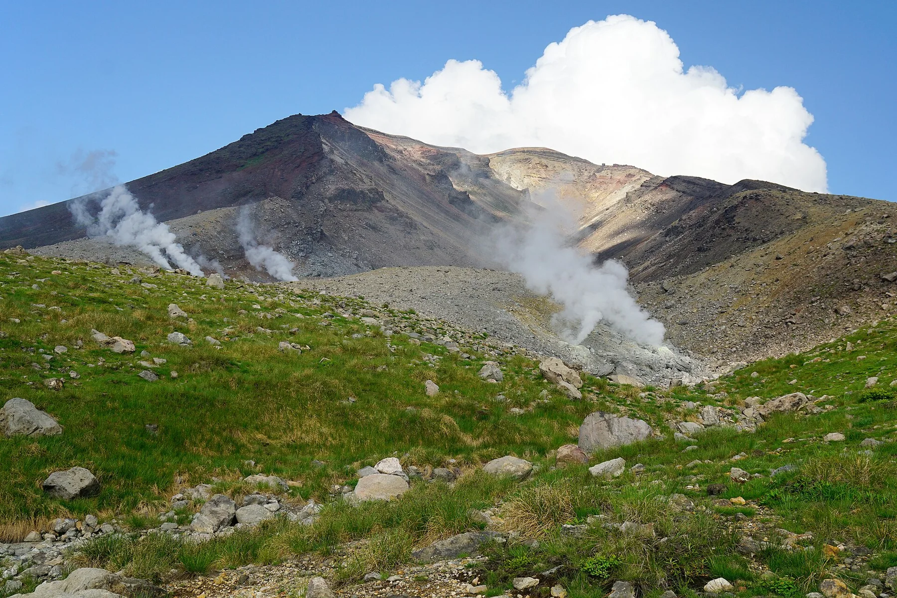
Azhdahak crater

Armenia's prominent volcanic summit contains a small crater lake above the open plateau.

Start early and make this the first exposed stop of the day. Keep a lower route ready if cloud, heat, wind or trail conditions change during Jun-Sep.

Look a little closer

Worth discovering

The details that make Geghama Mountains different.

Destination view
01

Azhdahak crater

Armenia's prominent volcanic summit contains a small crater lake above the open plateau.

Destination view
02

Rock carvings

Extensive petroglyph fields preserve long records of animals, movement and belief.

Destination view
03

Summer pasture

Seasonal herding keeps the high landscape active despite the scarcity of permanent settlements.

Photo journal

A closer look at Geghama Mountains

13 photographs
Deep background

Geghama Mountains beyond the first view

Volcanic plateaus, crater lakes, high pastures and extensive rock carvings form a little-known mountain landscape east of Yerevan. The view is only the surface of a longer story of formation, use and change.

The Geghama Mountains rise east of Yerevan as a broad volcanic range between the Ararat plain and Lake Sevan. Extinct cones, lava fields, crater lakes and open pasture create a high landscape with limited permanent settlement. Archaeological remains, especially petroglyphs, add a long human record to terrain that can otherwise appear austere and empty.

Visitors often encounter Geghama Mountains through the idea of “Azhdahak crater”, but the destination is more than that single scene. Its landscape carries evidence of work, movement, adaptation and environmental change. Armenia's prominent volcanic summit contains a small crater lake above the open plateau.

Continue to practical planning
Geghama Mountains — view 4See the complete photo journal
Physical setting

Why the terrain has this form

The first layer of Geghama Mountains is geological and ecological rather than scenic. Rounded volcanic summits and dark lava surfaces dominate the plateau, with Mount Azhdahak as the highest point. Small lakes occupy depressions beneath the peaks, while snowmelt feeds seasonal grassland. The absence of dense forest exposes geological form directly and allows expansive views toward Ararat, Sevan and the surrounding Armenian highlands.

The skyline is only the upper edge of a larger system. At Geghama Mountains, “Azhdahak crater” connects the high ground with valleys, settlement and the movement of water below. Armenia's prominent volcanic summit contains a small crater lake above the open plateau.

Human history

People, work and memory

At Geghama Mountains, daily life gives the terrain a historical meaning that a viewpoint alone cannot provide. Pastoral communities use the upper slopes seasonally, moving livestock into summer grazing areas. Thousands of carved rock images record animals, hunting, ritual and movement across the mountains over long periods. These layers make the plateau both an active working landscape and an archaeological archive whose meaning depends on its original spatial context.

At Geghama Mountains, the feature described as “Rock carvings” offers a second line of evidence. Extensive petroglyph fields preserve long records of animals, movement and belief. Within Geghama Mountains, it shows how local knowledge and practical use became embedded in the landscape.

Change

How access and attention changed the place

The decisive modern change at Geghama Mountains was access. At Geghama Mountains, transport and visitor infrastructure made the landscape easier to reach while concentrating pressure at the few points where roads, boats or trails enter it. At Geghama Mountains, the result is not a clean break with the past because earlier routes and habits continue to organise the present landscape.

On the ground

Three details that explain the whole place

Start with the feature “Azhdahak crater”, because it condenses a much larger part of the story of Geghama Mountains. Armenia's prominent volcanic summit contains a small crater lake above the open plateau. At Geghama Mountains, the detail links local scale with the wider regional pattern.

At Geghama Mountains, the feature “Rock carvings” is best understood as part of the surrounding system rather than an isolated stop. Extensive petroglyph fields preserve long records of animals, movement and belief. At Geghama Mountains, it gives a concrete reference point for reading change rather than merely collecting viewpoints.

At Geghama Mountains, the feature “Summer pasture” is best understood as part of the surrounding system rather than an isolated stop. Seasonal herding keeps the high landscape active despite the scarcity of permanent settlements. At Geghama Mountains, the detail links local scale with the wider regional pattern.

Season and scale

Season, scale and the present day

Geghama Mountains changes through the year because weather and biological cycles rearrange what can be seen and used. Access is concentrated in summer because snow persists across the high plateau well into spring. July and August bring green pasture and active camps, although storms and cold nights remain common. Early autumn is clearer and quieter but the weather window closes rapidly as the first snow returns.

For Geghama Mountains, the main seasonal constraint is: the strongest planning window is Jun-Sep. For Geghama Mountains, outside it, check weather, daylight, road or ferry schedules and seasonal closures before committing to a fixed route.

For Geghama Mountains, one practical detail matters: distances, fuel, food and mobile coverage can be less predictable than the map suggests. For Geghama Mountains, carry offline maps and keep a margin in the schedule.

Placed within its wider geography, Geghama Mountains is not an isolated exception. For Geghama Mountains, the wider context shows that, the Geghama range links Yerevan, the Garni and Geghard landscapes, and the western shore of Lake Sevan. For Geghama Mountains, it offers a broader understanding of Armenia as a volcanic highland where sacred sites, pastoral routes and water systems are distributed across connected elevations rather than isolated monuments.
Travel notes

Plan your visit

Time needed
3-5 days
Getting around
4x4 or local driver, with short walks at the main sites
Effort
Moderate to demanding
Plan first
Main transport and accommodation
Time of day
Start early for clearer conditions and more time
Best window
Jun-Sep
Traveller stories

Stories from people who have been here.

First-hand moments, practical notes and overlooked details from Geghama Mountains.

Loading traveller stories…

Browse all traveller stories ↗

Keep exploring

Where next?

All place stories