Float beneath waterfalls that drop directly into the river corridor
The trip combines easy current, shaded cliffs and surprising cascades in a region better known for open grassland.
Check water level and boat availability first; the route is strongest when the river becomes the main transport line rather than a short add-on.
Look a little closer
Worth discovering
The details that make Niobrara National Scenic River different.
Photo journal
01
Smith Falls
Nebraska's highest waterfall is reached from the river and a short trail.
Photo journal
02
Fort Falls
A cascade enters the canyon near Fort Niobrara.
Destination view
03
Pine and birch bluffs
Different forest communities meet along the river valley.
Photo journal
A closer look at Niobrara National Scenic River
9 photographs
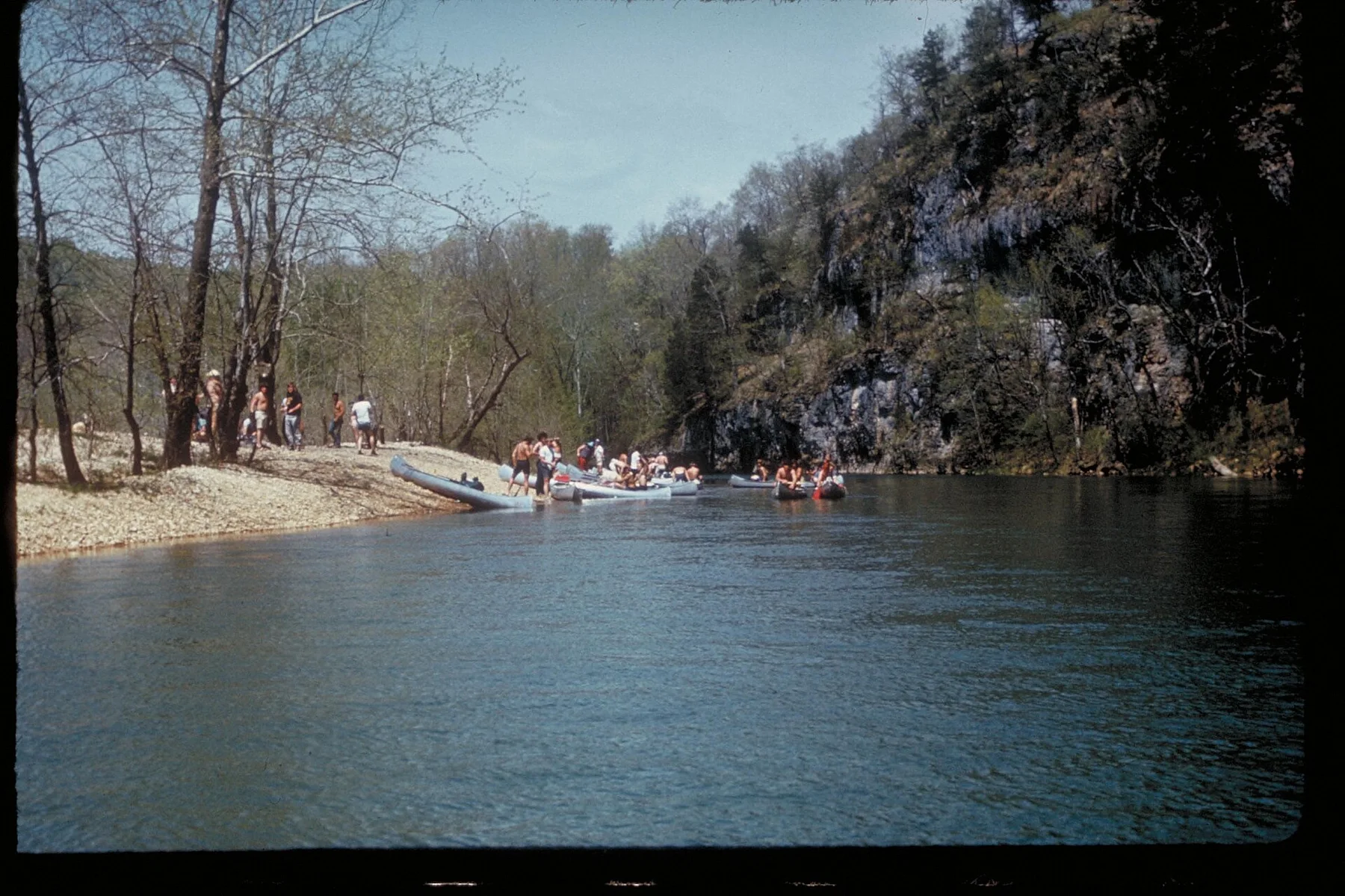
01Waterfall along the Niobrara NSR (2bd61542-1dd8-b71b-0b71-fd58f9642568)02Niobrara National Scenic River — view 203Stairstep Falls is found on one of the spring-fed creeks along the Niobrara NSR. (15cc5993-1dd8-b71b-0bbe-d06d12d6952d)04YCC Crew installs a new trail bridge. (f43fb8c0-fbc4-a250-c1f2-c46efab0e382)05Rafters challenge the Class III Rocky Ford rapid. (f5a8d2df-155d-4519-3ef3-695e8563e98a)06Smith Falls landing showing severe erosion due to overuse and inadequate protection of the river bank (4e1b155f-3d1b-4448-9618-4243edbf310e)07Fort Falls Overlook08Eastern Juniper in the forest at the Fred Thomas WMA (33e395d7-3d81-48ee-874e-2efb0a3b8a0b)09Niobrara River under Norden Bridge
Origins and change
The landscape memory of Niobrara National Scenic River
A spring-fed river passes beneath forested bluffs and dozens of small waterfalls in the Nebraska Sandhills. The view is only the surface of a longer story of formation, use and change.
4 min readNorth-central Nebraska, United States
Niobrara National Scenic River is centred on North-central Nebraska, where a spring-fed river passes beneath forested bluffs and dozens of small waterfalls in the Nebraska Sandhills. The strongest reason to make the journey is to float beneath waterfalls that drop directly into the river corridor.
The familiar invitation at Niobrara National Scenic River is “Float beneath waterfalls that drop directly into the river corridor”, yet that image makes more sense when it is connected to the landform, the local economy and the changes that determined access. The trip combines easy current, shaded cliffs and surprising cascades in a region better known for open grassland.
Understanding Niobrara National Scenic River starts below the visible surface. The river is both the visual centre and the practical route. Rapids, springs, cataracts or floodplains create a sequence that is lost when the visit is reduced to one roadside viewpoint.
Routes and settlements at Niobrara National Scenic River follow the water system even when the map emphasises roads. “Smith Falls” exposes that older logic. Nebraska's highest waterfall is reached from the river and a short trail.
02
Cultural landscape
Lives shaped by the terrain
The Niobrara valley was used by Ponca, Lakota and other Plains peoples, and later became a corridor for military posts, ranches and settlement. Fort Niobrara was established in 1879 during the reservation era and was eventually converted into a wildlife refuge.
The river's spring-fed cliffs and mixed ecosystems attracted canoe tourism in the twentieth century. National Scenic River designation in 1991 protected a long free-flowing section while leaving much surrounding land privately owned.
03
Modern history
The change that redefined the place
Conservation here depends on agreements with ranchers and landowners rather than a continuous public park. Old bridges, ranch access and the refuge reveal how the river's modern recreational identity developed from a settled corridor.
04
Visible evidence
What to read in the landscape
At Niobrara National Scenic River, the feature “Smith Falls” provides a precise clue to how the landscape works. Nebraska's highest waterfall is reached from the river and a short trail. Within Niobrara National Scenic River, it is both an attraction and a record of the processes described above.
At Niobrara National Scenic River, the feature “Fort Falls” is one of the most useful pieces of visible evidence. A cascade enters the canyon near Fort Niobrara. At Niobrara National Scenic River, it gives a concrete reference point for reading change rather than merely collecting viewpoints.
At Niobrara National Scenic River, the feature “Pine and birch bluffs” provides a precise clue to how the landscape works. Different forest communities meet along the river valley. At Niobrara National Scenic River, it gives a concrete reference point for reading change rather than merely collecting viewpoints.
05
Living landscape
The current chapter
At Niobrara National Scenic River, light, water and temperature reveal different structures at different times of year. For Niobrara National Scenic River, the most reliable visiting window is May-Sep.
For Niobrara National Scenic River, the stated visiting window is May-Sep, but its practical meaning depends on local weather, water and transport rather than the calendar alone.
Placed within its wider geography, Niobrara National Scenic River is not an isolated exception. Beyond the best-known image of Niobrara National Scenic River feature, Niobrara National Scenic River matters because fort falls and pine and birch bluffs place the destination inside a broader regional story.
Chronology
Key dates
A Plains river corridor
Communities used the valley for water, travel and seasonal resources.
Fort Niobrara established
The military post supported federal control during a period of forced Indigenous confinement.
National Scenic River designation
Federal protection focused on the river while most banks remained private.
Travel notes
Plan your visit
Time needed
2-4 days
Getting around
Boat, canoe or raft, with short land transfers
Effort
Moderate
Plan first
Water level, operator and return transport
Time of day
Start early and follow river conditions
Best window
May-Sep
Traveller stories
Stories from people who have been here.
First-hand moments, practical notes and overlooked details from Niobrara National Scenic River.