Panoramic ridge

Stoos Ridge Walk

A maintained ridge path links Klingenstock and Fronalpstock above Lake Lucerne with views on both sides.

Panoramic ridgeDramatic routeViewpointsKlingenstock summitRidge stairways

Location
Canton Schwyz, Switzerland
Best window
Jun-Oct
Suggested stay
Half day
Go for
Accessible alpine ridge traverse
The reason to go

Traverse the Klingenstock–Fronalpstock ridge

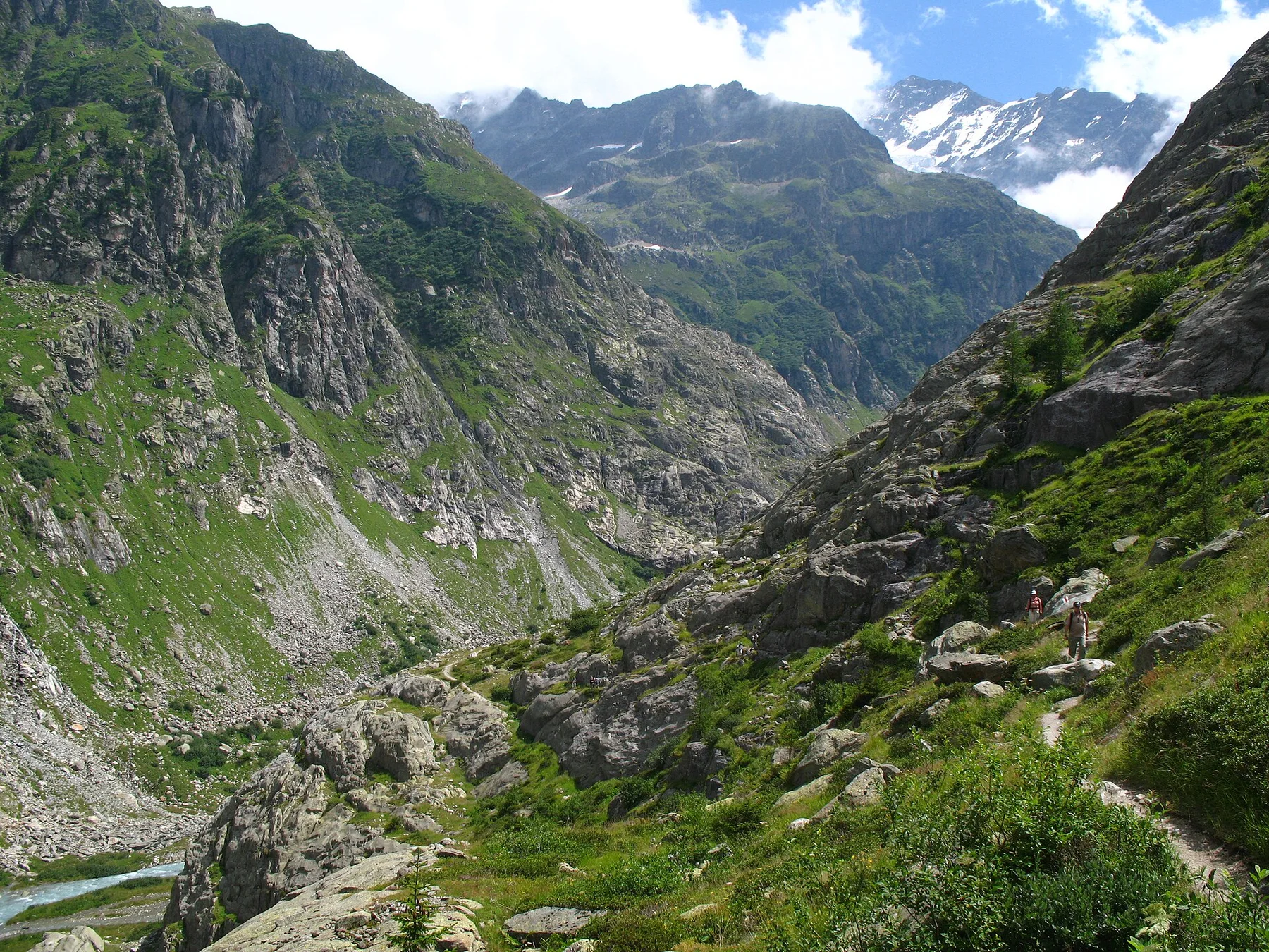
The route follows a clean grassy crest with Lake Lucerne far below and repeated changes of perspective toward the Alps and central Swiss lakes.

Use the lifts to create a one-way traverse and keep enough time before the final descent closes.

Look a little closer

Worth discovering

The details that make Stoos Ridge Walk different.

Destination view
01

Klingenstock summit

The higher starting point opens views toward the Uri Alps.

Destination view
02

Ridge stairways

Maintained steps follow the narrowest sections of the grassy crest.

Destination view
03

Fronalpstock terrace

The endpoint overlooks Lake Lucerne, Brunnen and the Rigi massif.

Photo journal

A closer look at Stoos Ridge Walk

8 photographs
Beyond the surface

A deeper history of Stoos Ridge Walk

A maintained ridge path links Klingenstock and Fronalpstock above Lake Lucerne with views on both sides. Its character becomes clearer when geology, settlement and modern protection are considered together.

Stoos Ridge Walk is centred on Canton Schwyz, where a maintained ridge path links Klingenstock and Fronalpstock above Lake Lucerne with views on both sides. The strongest reason to make the journey is to traverse the Klingenstock–Fronalpstock ridge.

Visitors often encounter Stoos Ridge Walk through the idea of “Traverse the Klingenstock–Fronalpstock ridge”, but the destination is more than that single scene. Its landscape carries evidence of work, movement, adaptation and environmental change. The route follows a clean grassy crest with Lake Lucerne far below and repeated changes of perspective toward the Alps and central Swiss lakes.

Continue to practical planning
Brunnen.SchwyzSee the complete photo journal
Origins

The forces behind the first impression

Understanding Stoos Ridge Walk starts below the visible surface. Changes in height, rock, water and exposure make the sequence important: the approach, the most engineered or natural passage and the final overlook each reveal a different part of Canton Schwyz.

The skyline is only the upper edge of a larger system. At Stoos Ridge Walk, “Klingenstock summit” connects the high ground with valleys, settlement and the movement of water below. The higher starting point opens views toward the Uri Alps.

Human history

People, work and memory

Stoos developed from a mountain farming settlement into a car-free resort served by funiculars and cableways. The ridge between Klingenstock and Fronalpstock was not created as an industrial path; it grew from pastoral access and Alpine hiking routes above Lake Lucerne.

Modern lift infrastructure changed who could reach the high ground and turned the traverse into a compact day route. The steepest funicular, opened in 2017, is now part of the destination's identity even though the ridge itself retains grazing land and traditional mountain use.

Reorganisation

The modern turning point

The key historical shift is accessibility: terrain once reached through sustained ascent can now be entered directly from a resort, concentrating walkers on a narrow crest and increasing the importance of trail management.

Visible evidence

Landmarks that carry the deeper story

At Stoos Ridge Walk, the feature “Klingenstock summit” provides a precise clue to how the landscape works. The higher starting point opens views toward the Uri Alps. At Stoos Ridge Walk, it gives a concrete reference point for reading change rather than merely collecting viewpoints.

At Stoos Ridge Walk, the feature “Ridge stairways” is one of the most useful pieces of visible evidence. Maintained steps follow the narrowest sections of the grassy crest. At Stoos Ridge Walk, the detail links local scale with the wider regional pattern.

At Stoos Ridge Walk, the feature “Fronalpstock terrace” provides a precise clue to how the landscape works. The endpoint overlooks Lake Lucerne, Brunnen and the Rigi massif. Within Stoos Ridge Walk, it is both an attraction and a record of the processes described above.
Continuity

Why the landscape still feels dynamic

A single visit to Stoos Ridge Walk captures only one phase of its annual cycle. For Stoos Ridge Walk, the most reliable visiting window is Jun-Oct.

For Stoos Ridge Walk, one practical detail matters: cloud can erase the main reason to go. For Stoos Ridge Walk, check visibility and lift operation before travelling to Stoos.

For Stoos Ridge Walk, the most useful visiting period is: morning for clear lake views.

Placed within its wider geography, Stoos Ridge Walk is not an isolated exception. Beyond the best-known image of Stoos Ridge Walk crossing, Stoos Ridge Walk is useful because ridge stairways and fronalpstock terrace place the route inside a broader landscape story.

Chronology

Key dates

  1. High grazing above Stoos

    Seasonal livestock use and local paths shaped the open ridge landscape.

  2. A car-free mountain resort

    Funicular and cableway access expanded tourism and winter sports.

  3. New Stoos funicular

    The exceptionally steep railway transformed the arrival experience and visitor capacity.

Travel notes

Plan your visit

Time needed
Half day
Getting around
Mountain railways and one-way ridge walk
Effort
Moderate; exposed ridge sections
Plan first
Lift schedules and weather
Time of day
Morning for clear lake views
Best window
Jun-Oct
Traveller stories

Stories from people who have been here.

First-hand moments, practical notes and overlooked details from Stoos Ridge Walk.

Loading traveller stories…

Browse all traveller stories ↗

Keep exploring

Where next?

All place stories